Des conseils, des trucs, des astuces...
Histoire de donner quelques conseils à tous ceux et celles qui souhaitent s'aventurer dans ces contrées, que ce soit à pied ou à vélo, et de répondre aux nombreuses questions qui nous sont posées, voici trois chroniques vélo portant sur la Mongolie, le Xinjiang et le Tibet. Bien sûr, comme les temps changent rapidement, il importe de se réinformer et de se faire sa propre opinion sur le sujet. Il peut tout de même s'agir d'un bon point de départ!
Attention, ces informations datent de 2005.À vélo en Mongolie
- Quand partir
- Quoi manger, quoi boire
- Où dormir
- S’orienter
- Communiquer
- Questions d’argent
- Attention!
- Petits conseils vélo
- Partir le coeur léger, la tête libre...
La Mongolie fait rêver. La steppe, ses milliers de chevaux galopant librement, son peuple à l'hospitalité légendaire. Mais la Mongolie est aussi un pays aride où les conditions climatiques, la rareté de l'eau et le régime alimentaire peuvent parfois transformer une belle aventure en véritable cauchemar.
Nous avons donc cru bon partager un peu de notre expérience afin de donner quelques trucs à ceux ou celles qui prévoient aller se balader dans cette contrée nomade.
Quand partir
Le vent. Le vent souffle et souffle dans la steppe. On y comprend comment plusieurs peuples en sont venus à aduler cet élément. De la fin avril à la mi-juin, le vent souffle vers l’Est. Il s’agit d’un facteur à ne pas négliger dans le choix de votre itinéraire. De la mi-juin à la fin août, la saison des pluies en Mongolie est amorcée. En ce qui nous concerne, cela s’est limité à quelques orages, un ou deux par jour, parfois très violents. Nous nous réfugions alors chez les gens ou nous continuions notre route vers le prochain éclairci. Paraît-il qu’il peut faire très froid dès septembre et que les routes couvertes de neige sont dangereuses.
Quoi manger, quoi boire
Dans la majorité des villages rencontrés, vous pourrez vous approvisionner en petits biscuits secs, petits sacs de nouilles séchées, galettes mongoles pour le matin et, si vous êtes chanceux, en chocolat! Certes le choix est restreint et il faut souvent prévoir des réserves pour plusieurs jours, certains villages n'ayant que peu de provisions. Les fruits et les légumes sont rares.
Il est également possible de manger dans des «guanz» qui sont, dans la majorité des cas, des yourtes transformées en petits restaurants où l'on vous servira des plats typiquement mongols: nouilles et mouton, riz et mouton, mouton et mouton, mouton quoi! Et bien sûr, un bol de thé salé. La difficulté de l'approvisionnement dépendra de l'itinéraire choisi, mais il ne faut surtout pas la sous-estimer.
Nous avons souvent mangé chez les gens qui s'empressaient de nous inviter dans leur yourte. C'est bien évidemment la meilleure façon de découvrir la Mongolie. Jamais personne ne nous a demandé ou semblait souhaiter une contribution financière pour le repas. Lors de notre passage dans une famille nomade (une dizaine de jours), nous avons "fait les courses" à quelques reprises dans un village avoisinant, contribuant ainsi aux repas de toute la famille.
Pour ce qui est de l'eau, cela dépend encore une fois de l'itinéraire choisi. La route que nous avons empruntée était plutôt désertique et peu fréquentée. Nous transportions donc avec nous près de 22 L d'eau et faisions le plein dès que cela était possible. Malgré tout, nous avons eu soif. Toutefois, la situation est tout à fait différente dans le centre ou le Nord du pays. Nous avons toujours filtré notre eau.
Prix rencontrés en 2005:- En général, un plat coûte entre 1000 et 1500 tugrik
- Sac de nouilles séchées entre 150 et 300 tugrik.
- Un paquet de biscuits entre 500 et 800 tugrik, mais de les acheter en vrac revient moins cher.
En juin 2005, 1$ US équivaut à environ 1 100 tugrik.
En avril 2010, 1$ US équivaut à environ 1 360 tugrik
Où dormir
En Mongolie, rien de plus simple que de trouver un endroit où planter sa tente. Souvent, les Mongols vous inviteront à camper près de leur yourte et à partager un repas avec eux. Sinon, il suffit de se trouver un coin à l'abri du vent et parfois à l'abri des regards si l'on veut être plus tranquille.
S’orienter
À gauche, à droite ou tout droit? Même les chauffeurs se perdent en Mongolie. Certaines régions sont mieux tracées que d’autres, mais dans la steppe, dès qu’une piste devient mauvaise, on en crée une nouvelle. Ainsi, il peut être facile de se perdre en ce pays. D’abord, petit conseil, toujours demander à plus d’une personne votre chemin. Nous avons souvent surestimé notre compréhension de la langue et du langage corporel mongols. Il faut aussi s’assurer que la piste visée existe toujours et n’est pas une piste pour chevaux.
En 2005, il était possible de se procurer un atlas routier mongol à Ulaan Baatar, notamment au Centre d’information. Assurez-vous d’avoir les noms des villes et des villages à la fois dans la langue mongole et dans la langue anglaise. Une carte topographique détaillée est essentielle pour ceux qui souhaitent voyager hors des pistes principales. Souvent, nous avons roulé sur plus de 300 km sans rencontrer âme qui vive. Il faut alors pouvoir se débrouiller pour s’orienter. De notre côté, nous n’avions pas de GPS.
Communiquer
Sain Bainuu! Bien sûr, on ne veut pas se limiter aux simples salutations d'usage! De savoir quelques mots de cette langue qui à prime à bord semble si complexe vous permettra non seulement d'acheter votre nourriture et de demander votre chemin, mais surtout de partager un peu plus que l'espace d’un instant votre intérêt pour les gens qui vous accueillent dans leur demeure.
Nous avons regretté ne pas avoir mis plus de temps avant notre départ dans l’apprentissage de cette langue. Nous vous le suggérons donc fortement. Nous avions avec nous un «Phrase Book» de Lonely Planet où nous trouvions des phrases utiles pour communiquer. Nous avions aussi un petit dictionnaire de poche Anglais-Mongol (acheté à Ulaan Baatar) qui complétait merveilleusement le premier. Essentiel! Finalement, nous avions fait traduire l'essence de notre projet dans toutes les langues des pays ou régions que nous traversions. Cela nous permettait d'être mieux compris et suscitait beaucoup d'intérêt.
Questions d’argent
Ulaan Baatar est certes l'endroit où vous pourrez faire le plein de devises mongoles. Visa et Mastercard acceptées. Par la suite, les seules villes où vous pourrez refaire le plein sont les capitales de aimags (provinces mongoles), mais encore là des pannes de courant ou autres problèmes techniques peuvent régulièrement survenir. Il vaut mieux avoir beaucoup d'argent sur soi. De notre côté, nous n'avons jamais eu de problème à retirer de l'argent avec notre carte Visa. En 2005, il n'y avait pas de guichet automatique en Mongolie.
Attention!
L'alcool est un problème en Mongolie. À plusieurs reprises, nous nous sommes faits harceler, voire même agresser par des hommes en état d’ébriété. À toutes les fois, nous nous trouvions dans des villages, surtout dans les capitales de aimags. Il nous a semblé que l'alcool faisait parfois ressortir de mauvais souvenirs face à l'étranger (époque communiste russe) et notre présence n'était pas toujours appréciée. Nous n'avons jamais vécu de telles situations dans la steppe, mais les villes sont réellement à éviter (mis à part pour se ravitailler), surtout le soir.
Petits conseils vélo
Apportez avec vous toutes les pièces de rechange, vis incluses, car vous trouverez difficilement ce dont vous aurez besoin pour réparer votre vélo à l'extérieur de la capitale. Les Mongols sont par contre de brillants bricoleurs.
Mis à part les 300 km de routes pavées qui bordaient la capitale en 2005, nous avons roulé sur des «routes» de terre, de sable, de cailloux, traversé des rivières et des torrents, passé des cols de plus de 4000 mètres d’altitude, etc. Une véritable expédition. Nous avions opté pour un vélo de montagne de base, sans suspension, afin de limiter les possibilités de bris. Nous n'avons jamais regretté ce choix. Les routes étant extrêmement accidentées, nos supports à bagages se sont brisés à plusieurs reprises. Nous vous conseillons de les choisir judicieusement.
Partir le coeur léger, la tête libre...
Avec le temps, nous avons compris que la meilleure façon de découvrir un pays était de partir avec le moins d’illusions possible. C’est ce que nous vous souhaitons. La Mongolie est encore épargnée de ce que l’on pourrait appeler le tourisme de masse et il est du devoir de chaque visiteur de faire en sorte qu’elle le soit le plus longtemps possible.
À vélo au Xinjiang
Brochettes sur le grill, pains naan directement sortis du four, melons sucrés et épices de toutes sortes, le Xinjiang vous ouvre ses portes! Certes la route y est plus facile qu’en Mongolie, les routes principales étant majoritairement pavées ou en voie de l’être, mais le Xinjiang offre aussi ses difficultés, qui somme toute lui confèrent un charme exceptionnel.
Quand partir
Nous sommes entrés au Xinjiang à la fin juillet, soit en plein cœur de l’été. À cette période de l’année, il y fait très chaud. Le désert du Taklamakan l’est tout particulièrement. Ses températures avoisinent quotidiennement les 45°C. De là l’importance de circuler tôt le matin et tard en journée et de s’informer sur la présence ou non de puits sur la route. De violentes tempêtes de sable peuvent surgir dans cette région où les vents sont parfois déchaînés.
Les hivers sont plus ou moins rudes selon les régions et les précipitations de neige varient du Nord au Sud, étant plus faibles dans les régions désertiques. Il est probablement possible d’y voyager à vélo à cette époque de l’année. Une chose est sûre, voyager à vélo au Xinjiang peut devenir une véritable expédition en soi, dépendamment de l'itinéraire choisi!
Quoi manger, quoi boire
Le Xinjiang offre toute une variété de fruits, de légumes, de glaces, de jus et de boissons, de pains et d’épices. Partout vous trouverez le banmian, plat typiquement ouïghour, composé de pâtes fraîches, de légumes sautés et de piments forts. L’eau abonde dans certaines régions et la plupart des villages pourront même vous l’offrir froide! Ainsi, le Xinjiang ne pose pas vraiment de difficulté côté nourriture, mis à part les grandes régions désertiques où il importe de bien s’informer sur l’existence réelle de tel ou tel village et sur l’emplacement des points d’eau. Nous avions toujours avec nous près de 22 litres de cet élixir de vie et parfois, nous en aurions pris plus. Avec de bonnes réserves et de bonnes informations, vous pourrez parcourir le Xinjiang sans trop de casse-tête.
Prix en 2005- Banmian - entre 5 et 8 yuans, mais jamais plus de 8 yuans.
- Plats typiques (soupe de ravioli, riz et légumes sautés, etc.) - entre 3 et 10 yuans.
- Eau en bouteille - 1,5 yuan.
- Jus et boissons gazeuses - entre 2 et 3 yuans.
À notre avis, il est du devoir de chacun de tenter de s’informer des prix avant d’acheter. Essayez de leur laisser d’autres souvenirs que celui d’un touriste «riche» que l’on peut rouler à tout coup...
Où dormir
Le Xinjiang est composé de vastes étendues désertiques et semi-désertiques où vous n’aurez aucune difficulté à trouver un emplacement pour votre tente. Il sera par contre difficile de faire de même près des grandes villes où vous pourrez trouver une chambre d’hôtel entre les 45 et 200 yuans (en 2005), dépendamment de l’intérêt touristique de la place (Ürümqi, Kashgar et Turpan étant plus dispendieux).
ÜrümqiGambuch Hotel, au cœur du quartier ouïghour, à 100 yuans la chambre à l’époque, bruyant et chaud, mais l’ambiance y est. À ne pas confondre avec l’hôtel plus luxueux situé juste à côté où une tour lumineuse parsemée de fluorescents multicolores éclaire la nuit. Le moins cher en ville.
TurpanNombreux sites d’intérêt dont la vallée des raisins et l’ancienne cité de Jiaohe. La «banlieue» ouïghoure est excessivement charmante. Ici, les tarifs sont plus élevés. Nous n’avons pu trouver mieux qu’une chambre à 140 yuans.
Sinon, dans les autres villes, il semble possible de trouver des chambres entre les 45 et 70 yuans, toujours en discutant des prix bien sûr. Les Ouïghours sont très hospitaliers, n’hésitez pas à saisir les opportunités qui s’offrent à vous!
S’orienter
Nous nous sommes procurés notre carte du Xinjiang avant notre départ. Il est toutefois possible d’en acheter à Ürümqi (et probablement dans d’autres villes comme Turpan, Korla ou Kashgar). Les cartes touristiques autorisées par la Chine omettent parfois d’indiquer les villages ouïghours… D’autres fois, elles indiquent la présence de villages chinois dans les régions désertiques qui sont dans les faits abandonnés depuis déjà plusieurs années. Ce fut particulièrement le cas sur la route entre Korla et Ruoqiang. Il importe donc de bien s’informer auprès de la population locale avant de se lancer dans une escapade du désert qui pourrait autrement mal tourner! Certaines régions du Xinjiang nécessitent des permis spéciaux, les agences touristiques pourront vous informer à ce sujet. Sinon, le système routier est bien développé.
Communiquer
La Chine a «libéré» le Xinjiang en 1950 et depuis ne l’a jamais quitté. Le peuple Ouïghour a longtemps été majoritaire dans la région, mais voit aujourd’hui son poids démographique grandement diminué face à la migration massive d’Hans venus de la Chine orientale. Les Ouïghours représentent aujourd’hui environ 40 % de la population totale du Xinjiang alors qu’ils représentaient 70% de la population il y a à peine 20 ans. Ainsi, un dictionnaire ouïghour peut être plus qu’intéressant si vous souhaitez échanger avec ce peuple chaleureux. Un « Phrase Book » en mandarin est également essentiel puisque les Chinois représentent aujourd’hui 40 % de la population totale du Xinjiang. Plus au Nord, vous rencontrerez des Kazakhs qui sont également très hospitaliers.
Un peu plus
Les questions d’argent et de mécanique vélo ne posent aucun problème dans cette contrée où les gens marchandent depuis des millénaires. Pour nous, cette région du monde est un véritable coup de cœur… La culture ouïghoure est certes à découvrir et l’ambiance qui y règne nous rappelle qu’il n’y a pas si longtemps, cette route était celle de la soie.
Ici, nous avons encore une fois appris à quel point la générosité peut faire d’un instant un moment de magie dont on se souviendra longtemps…
Bonne route!!!
À vélo au Tibet
- Les voies d’accès
- Les postes de contrôle et le plateau tibétain
- Lhasa et la Friendship Highway
- État des routes, ravitaillement et tourisme
- Frontière népalaise
Le Tibet... Il suscite depuis longtemps la curiosité, mais son accès est toujours restreint et interdit, en quelque sorte, aux voyageurs individuels. En réalité, il est possible d’obtenir d’une agence touristique un permis pour une ou deux personnes qui vous amènera en autocar de Kermo jusqu’à Lhasa, sans toutefois pouvoir en débarquer en cours de route. Il en coûtait environ 1 700 yuans par personne en 2005, incluant le transport et quelques nuits à l’hôtel.
Comme vous le savez probablement, il est désormais possible de rejoindre Lhasa par train, un train qui somme toute facilite grandement l’immigration massive de Chinois provenant de la Chine orientale.
Les voies d’accès
Nous sommes entrés au Tibet via Kermo (Golmud) puisque nous arrivions du désert du Taklamakan, c’est-à-dire de la province autonome du Xinjiang. Les voies d’accès depuis Kashgar, Xining ou Chengdu semblent beaucoup plus intéressantes puisque moins utilisées et plus diversifiées, mais nous n’avons évidemment aucune information sur ces trajets.
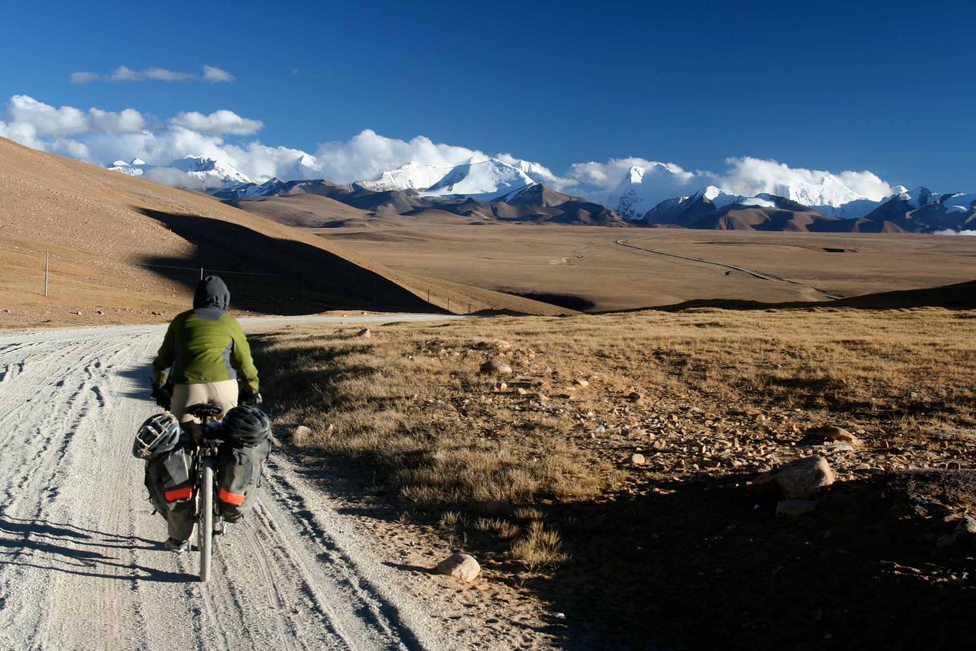
La route entre Kermo et Lhasa est complètement asphaltée et très empruntée (camions, jeep, voitures de police, convois d’armée). Cette route culmine à 5 700 mètres et sillonne le plateau tibétain, offrant un paysage d’altitude qui, après plusieurs semaines de désert, nous a bien sûr charmé… Vous commencerez à rencontrer plusieurs villages tibétains à environ 600 ou 700 kilomètres au Sud de Kermo.
Les postes de contrôle et le plateau tibétain
2005 - Le premier poste de contrôle se trouve à 5 km du centre-ville de Kermo, immédiatement après le Pétro-China. Vous ne pourrez pas le manquer, toutes les voitures doivent s’y arrêter. Nous l’avons contourné de nuit, par la droite, nous éloignant le plus possible de la route. Le terrain est difficile, avec beaucoup de relief et très sablonneux.
Le deuxième poste de contrôle se situe à 40-45 km de Kermo et est à notre avis très difficile à contourner à vélo de jour. Nous l’avons fait de nuit en longeant le mur à droite du poste (à environ 150 mètres des gardes) pour ensuite longer l’arrière des stations-services qui le suivent. Il est impossible d’aller plus à droite, un barrage hydro-électrique barre le chemin.
Sur la route, des dizaines de voitures de polices nous ont dépassés sans broncher. Nous avions des provisions pour plusieurs jours et passions rapidement dans les villages. Nous nous cachions toujours pour manger ou pour dormir.
Contrairement à ce que nous avions eu comme information, il n’y avait aucun poste de contrôle à 450 ou 500 km de Kermo (soit aux environs de Marchudram Babsuk ou Tuotuohe). Il y en avait toutefois un à Amdo, mais il s’agissait seulement d’une pesée pour les camions, les voitures n’étant pas contrôlées et passant par la gauche (facile pour les vélos). Celui qui est à l’entrée de Lhasa était fermé lors de notre passage étant donné la température, mais certains cyclistes nous ont dit y avoir passé sans problème.
Ainsi, nous avons pu rejoindre Lhasa sans trop de difficulté. L’eau abonde sur le plateau et il est possible de se procurer des « Quick noodles » dans les villages (en le faisant discrètement et rapidement bien sûr). Le nouveau chemin de fer s’avère être d’une grande utilité pour se protéger des intempéries (tempêtes de neige, de pluie ou de vent) ou pour se protéger des regards la nuit venue. La pluie est assez fréquente sur le plateau en septembre.
Lhasa et la Friendship Highway
Lhasa ne pose absolument aucun problème pour les intransigeants du vélo. Le permis n’est jamais demandé et il est possible d’y circuler en toute liberté, sans aucun souci. Pour ce qui est de la route menant au Népal, la Friendship Highway, elle est supposément ouverte aux étrangers et ne nécessite aucun permis, à condition de ne pas quitter la voie principale. Nous l’avons toutefois fait en passant par Gyanste tout en s’arrêtant dans quelques villages et n’avons eu aucun problème. La route passant par Gyanste est magnifique, parsemée de lacs turquoise et bordée de glaciers et de sommets de plus de 7000 mètres.
État des routes, ravitaillement et tourisme
Au moment de notre passage en 2005, d’importants travaux avaient lieu sur la Friendship Highway, la route principale menant au Népal, rendant le tout très poussiéreux, boueux et peu agréable à circuler. Côté ravitaillement, l’eau y abonde et il est relativement facile de s’y faire des provisions pour plusieurs jours. Il ne s'agit donc pas là d'un problème majeur.
Sur cette route, le tourisme a fait des ravages. À quelques reprises, nous avons été témoins d’autocars s’arrêtant quelques minutes aux abords des champs, permettant à ses passagers pressés d’aller photographier des Tibétains en plein labeur, sans en demander la permission, sautant dans le bus après avoir croqué leur cliché de l’année. Inutile de commenter… Simplement, nous pensons qu’il est primordial que chacun d’entre nous saisisse l’impact que nous avons en tant que touriste, que ce soit sur le sol que nous foulons ou sur les peuples que nous rencontrons.
Frontière népalaise
Pour ce qui est du passage à la frontière népalaise, nous y sommes passés en fin de journée (le matin étant particulièrement occupé). Le douanier chinois nous a demandé si nous avions le Alien Travel Permit. Ne l’ayant pas, il nous a demandé combien de temps nous avions passé entre Lhasa et la frontière népalaise. De façon on ne peut plus synchronisée, nous avons répondu en chœur «10 jours»! Souriant, il nous a estampé notre passeport et le tour était joué! Il semble, (selon nos sources), que la réponse idéale pour les « sans-papiers » doive se situer sous les deux semaines...
Pour ce qui est de la grande descente, préparez-vous à vivre les émotions de toute une vie!
DVD

Livre

Trame sonore du DVD

